Real-time WDSSII Weather Data
CONUS Data Continental US Radar Regional Radar (6 sectors) Colorbars and contrast adjustment Research Data All Research Products Loops Regional Radar: NW, SW, NCentral, SCentral, NE, SE, Gulf Coast, SPlains Satellite: Visible, IR, Water Vapor Archived Products NSSL OnDemand Verification System About Accessing the Data Notice: It is normal for this experimental data feed to experience temporary outages. |
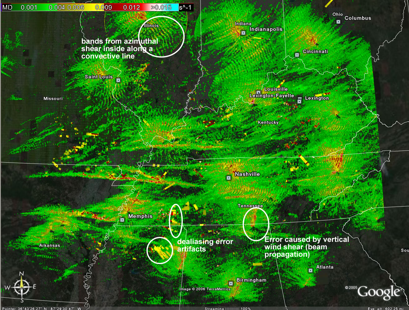
About the productsThe radar images are updated every 5 minutes (2 minutes for velocity products), and have a 1 km grid resolution. Data are merged from WSR-88D radars across the contintental United States. Regional radar images should load faster than the continental grid. The images are no longer in geotiff format, but are PNG files with the geographic information embedded in the asociated KML file. NWS warning polygons are updated every minute, while storm report maps are updated hourly.
Scientific Background InformationThe continental US (CONUS) WDSSII system is described in:
while a brief description of the products in Google Earth are:
The reflectivity quality control technique:
How the "Rotation Tracks" product is derived:
A preliminary evaluation of the spatial hail size estimation ("Hail swath") products, as compared to the WSR-88D products:
Merging data from multiple radars:
|
Disclaimer: Use at your own risk. Data are experimental and may experience any number of problems including being late or not being available at all. Do not use for protection of life or property, or for any commercial use without permission.