WDSS-II
NOTICE: It is normal for this experimental data feed to experience occasional outages.
Experimental Real-time products
KML / Geotiff images (Google Earth / GIS)
Web (PNG) images and loops
About the products
WDSSII information
wdssii.org |
About the products
The continental US (CONUS) WDSSII system is described in:
- Lakshmanan, V., T. M. Smith, K. Cooper, J. J. Levit, G. J. Stumpf, and D. R. Bright, 2006: High-resolution radar data and products over the Continental United States. 22nd Conference on Interactive Information Processing Systems, Atlanta, Amer. Meteor. Soc.
- Lakshmanan, V., T. Smith, G. J. Stumpf, and K. Hondl, 2006 (accepted): The warning decision support system - integrated information (WDSS-II). Weather and Forecasting.
while a brief description of the products in Google Earth are:
- Smith, T.M. and V. Lakshmanan, 2006: Utilizing Google Earth as a GIS platform for weather applications. 22nd Conference on Interactive Information Processing Systems, Atlanta, GA, Amer. Meteo. Soc.
The reflectivity quality control technique:
How the "Rotation Tracks" product is derived:
- Smith, T.M. and K. L. Elmore, 2004: The use of radial velocity derivatives to diagnose rotation and divergence. Preprints, 11th Conf. on Aviation, Range, and Aerospace, Hyannis, MA, Amer. Meteor. Soc., P5.6 - CD preprints.
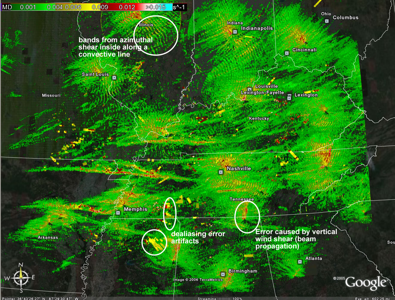
- and some Rotation Tracks issues are described in this picture.
A preliminary evaluation of the spatial hail size estimation ("Hail swath") products, as compared to the WSR-88D products:
- Ortega, K.L, and T.M. Smith, 2006: Verification of multi-sensor, multi-radar hail diagnosis techniques. 1st Severe Local Storms Special Symposium, Atlanta, GA, Amer. Meteo. Soc.
Merging data from multiple radars:
- Lakshmanan, V., T. Smith, K. Hondl, G. J. Stumpf, and A. Witt, 2006 (in press): A real-time, three dimensional, rapidly updating, heterogeneous radar merger technique for reflectivity, velocity and derived products. Weather and Forecasting.
|